
The West Shore Address-Level Due-Diligence Checklist for Buyers
West Shore is a location, not a jurisdiction. Before you write an offer on a specific address, you need one dated file that ties that exact parcel to the right county, the right TRPA record, and the right permit and title history. This is how to build it, and the order matters.
The trap is assuming that records sharing an address describe the same property. A county assessment lookup, a TRPA parcel record and a recorded deed can each return something plausible for one street address and still disagree with each other. Where they disagree, that is the finding. It is not a formatting problem to smooth over.
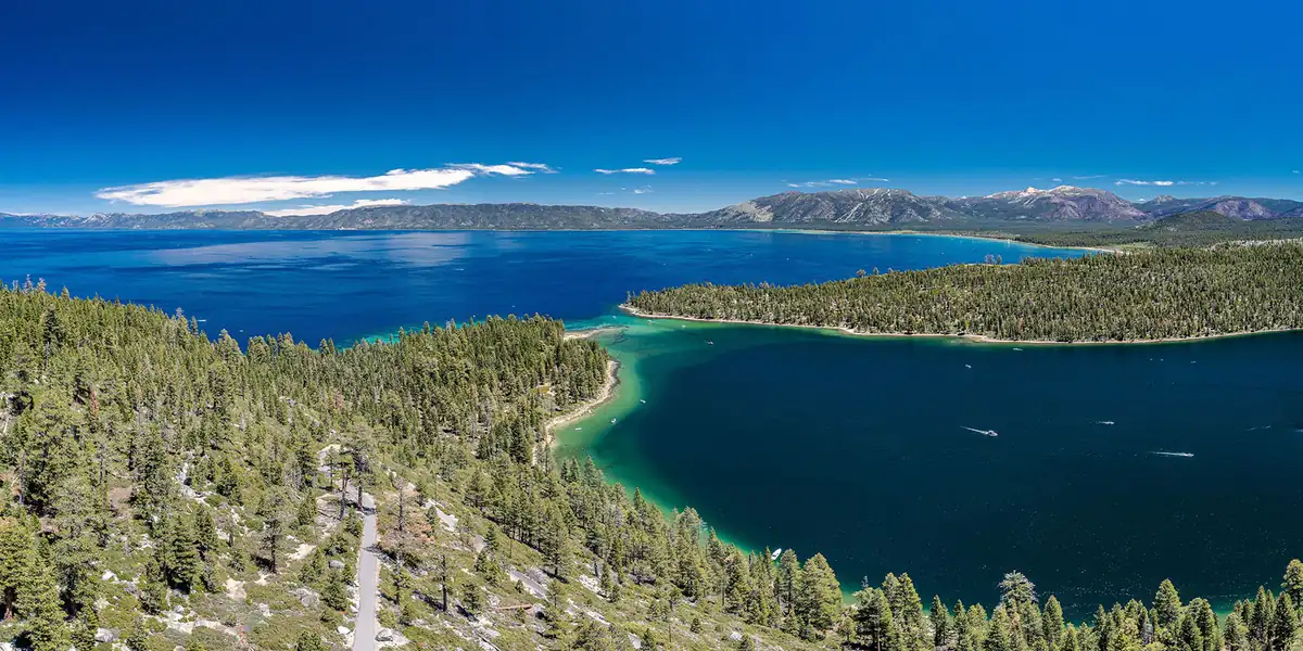
The jurisdiction question comes first, because it decides which systems you search at all. The West Shore spans two counties, and the line runs straight through Tahoma: the north end toward Homewood is Placer County, the south end toward Meeks Bay and Rubicon is El Dorado. Two houses on the same stretch of shoreline can file with different counties. The parcel decides that, not the mailing address.
What follows works through it in order: fix the identity, read TRPA and county records together, reconcile permits against what you can actually see, search the correct assessor and recorder, then add wildfire, flood, access, survey and title evidence. Every step ends in a dated note rather than an assumption.
Fix the exact address, APN, county, TRPA parcel, and contract property
Start a single dated identity sheet before joining any West Shore records. Copy the street address, Assessor Parcel Number, legal description, county, TRPA parcel or file number, assessment identifier, access documents, and property description from the fully signed purchase contract. Record the URL and retrieval date for each official result. If two identifiers conflict, preserve both and assign the mismatch for written resolution rather than choosing the more convenient answer.
For a Placer County parcel, open the county Property Details search and use the exact Fee Parcel Number or Assessment Number. Save the stated assessment date and the county's warning that the data should be validated before business decisions. This surface can route an assessment record; it does not establish the legal building site, controlling survey boundary, title, legal use, current condition, or exact contract property.
For an El Dorado County parcel, use the county Parcel Data and Building Design Criteria lookup with the exact APN digits it requests. Preserve the site's accuracy disclaimer. A county parcel result still must be reconciled with the contract, legal description, TRPA record, recorder documents, survey, and title work. West Shore is a location label, not a substitute for the parcel's actual jurisdiction.
Keep this identity lane separate from pricing. The Tahoe City comparable-sales offer-price guide can organize market evidence, but a comparable sale cannot resolve which public record, legal description, or jurisdiction belongs to the subject property.
Read TRPA and county planning and building records together
Use the TRPA Permitting Procedure Manual to follow the documented Parcel Tracker route. Search by the exact address, TRPA file number, or parcel number, then preserve the parcel record, applications, submitted materials, assigned planner, and every unresolved condition or identifier. Treat a Parcel Tracker result as a research route, not a conclusion about land capability, allowable coverage, legal use, permit completeness, present compliance, title rights, or physical condition.
Next, route the same APN and address to the correct county. Placer County Building Services identifies a Tahoe division and provides eServices for permit-history review. If El Dorado County is responsible, retain the county parcel and building-criteria result, then request the address-level building file through the appropriate county office. Keep TRPA and county records in adjacent columns because their scopes differ.
Write the buyer's intended present use and any future work as separate questions. Occupancy, rental activity, an addition, redevelopment, a deck, defensible-space work, or another project may implicate different records and professional review. Ask the responsible planner or building office a parcel-specific question containing the APN, legal description, current record, proposed scope, and exact uncertainty. Preserve the response and date; do not convert a routing answer into an approval.
The Tahoe City buying-and-selling coordination guide can help keep timing decisions organized, but it supplies no parcel, permit, title, or contract conclusion for a West Shore purchase.
Reconcile permits and observed improvements
Build a permit chronology keyed to the exact address and APN. Record each application, approved plan, amendment, inspection, correction, certificate, and final disposition separately. The Placer County building page and online history are starting points; they do not prove a complete file, approved scope, inspection sequence, final status, code compliance, present condition, or that observed work matches approved documents.
During the property inspection, compare each material improvement with the permit file. Match the apparent location and scope of additions, decks, structural repairs, mechanical systems, electrical work, site work, and other changes to plans, permit descriptions, inspections, and final records. When a change cannot be reconciled, request the complete file and route physical, structural, code, and legal questions to the responsible inspector, architect, engineer, licensed trade, or attorney.
Do not use the absence of an online entry as proof that work was never done, required no approval, complied with code, or received final sign-off. Record the search terms, identifiers, date, result, and office response. Keep unknowns visible until the controlling file and responsible professional answer the exact question.
The Tahoe City seller asking-price evidence guide belongs in a different evidence lane. An asking-price analysis cannot validate a permit history or convert observed improvements into approved work.
Search the correct assessor and recorder systems
Use the identity sheet to select the correct county assessor and recorder. For Placer County, keep the assessment record separate from the Clerk-Recorder's Real Property Records route. Preserve the grantor-grantee index entries, document numbers, recording dates, parties, legal-description references, and official-copy requests. The county explains that scanned images are not available online, so note when an index entry must be followed by an official copy.
For El Dorado County, use the Recorder-Clerk Official Records Search by the exact parties, document number, book and page, document type, and other applicable fields. Preserve each search path and result. Never blend a Placer record with an El Dorado record merely because the address or owner name looks similar.
Create a chronology for deeds, liens, releases, easements, restrictions, plats, access instruments, and other relevant documents. Keep the public index, recorded copy, title commitment, survey, and attorney analysis in distinct columns. An index entry or document does not by itself decide legal effect, priority, release, boundary, access rights, exceptions, or insurability.
West Shore buyer address-level due-diligence record
| Decision lane | Exact identifiers | Official surface | What it can show | What it cannot decide | Follow-up owner |
|---|---|---|---|---|---|
| Identity and jurisdiction | Address, APN, legal description, county, TRPA record, assessment ID, contract description | TRPA and county assessor systems | Record routing, parcel and assessment context | Title, survey boundary, legal use, access, condition, or contract property | Buyer, attorney, title, surveyor, TRPA and county offices |
| Planning and land coverage | APN, TRPA file, land capability, coverage, application, planner and condition IDs | TRPA Parcel Tracker and permitting records | Parcel, application and planner routing | Complete approvals, legal use, allowable coverage, compliance or future approval | TRPA, county planning, attorney, architect, engineer |
| Permits and improvements | Address, APN, permit, plan, inspection, correction and final-status IDs | Placer or El Dorado building records | Permit-history and building-review routes | Complete history, present condition, compliance, approved scope or final sign-off | Building staff, inspector, architect, engineer, attorney |
| Assessment and recording | County, APN, legal description, parties, document, deed, lien, release, easement and plat IDs | County assessor and recorder systems | Assessment and recorded-document search results | Complete title, legal effect, priority, boundary, access, exceptions or insurability | Attorney, title, surveyor, assessor and recorder |
| Hazards and final decision | Address, coordinates, APN, structure, fire zone, flood panel, effective date, insurance and lender results | CAL FIRE, FEMA and complete transaction file | Official hazard-map routing and dated decision evidence | Actual loss, structure vulnerability, coverage, premium, lender treatment or contract outcome | Buyer, insurer, lender, fire-safety professional, surveyor, engineer, attorney |
When the APN, legal description, county, TRPA record, assessment record, recorder chain, access instrument, or survey does not align, stop the join. Have the title professional, attorney, surveyor, assessor, recorder, TRPA, or county office resolve the specific discrepancy.
Add wildfire, flood, access, survey, title, and insurance evidence
Open CAL FIRE's Fire Hazard Severity Zones surface and preserve the current official result for the exact address and parcel. CAL FIRE distinguishes mapped hazard, based on fire likelihood and expected behavior, from property-specific risk. The mapped zone does not decide actual loss, structure vulnerability, defensible-space compliance, coverage availability, premium, lender treatment, or a transaction decision.
Use FEMA's Map Service Center search options by the exact street address, place, or coordinates. Preserve the official product, map or panel number, effective date, zone, coordinates, and any map-change material. Confirm that the parcel and structure are correctly located through the responsible surveyor, engineer, insurer, lender, attorney, and agencies. A search pin or layer does not prove whether a structure will flood or settle coverage, premium, lending, or contract questions.
Review access in its own lane. Compare the legal description, recorded easements, plats, survey, visible route, maintenance documents, and title exceptions. A road visible on a map does not establish a legal right to use it or allocate maintenance. Route legal-effect questions to the buyer attorney and title professional and physical-location questions to the surveyor.
Organize inspection, engineering, drainage, geotechnical, utility, water, sanitation, wildfire, insurance, lending, and other specialist evidence according to the actual property and signed deadlines. Leave unsupported fields unknown. The Crystal Bay address-level due-diligence guide can help structure a neighboring parcel-verification workflow, but it supplies no West Shore property fact or transaction result.
Turn every mismatch into a dated contract decision
Maintain a decision log with the issue, exact source, retrieval date, what the evidence establishes, what it does not establish, missing fact, responsible professional, contract deadline, required notice route, and final disposition. Examples include an APN or county mismatch, legal-description difference, unresolved TRPA condition, incomplete permit sequence, unreleased recorded item, uncertain access, wildfire-map question, flood-map mismatch, or an insurer or lender requirement.
Copy every controlling deadline and notice requirement from the fully signed transaction documents. Do not rely on a generic timeline. Have the buyer attorney and licensed transaction professionals interpret transaction-specific rights, notices, objections, waivers, deposits, and remedies. Use planners, building staff, inspectors, surveyors, engineers, title professionals, lenders, insurers, fire-safety professionals, and other specialists only for questions within their scope.
Before a deadline passes, read the identity sheet, TRPA and county files, permit chronology, assessor and recorder records, title and survey evidence, CAL FIRE and FEMA materials, inspection and specialist reports, lender and insurer responses, and unresolved-item log together. The decision record should name the evidence reviewed and the assumptions still open. Never convert an official webpage, an empty search, or a clean index into a guarantee.
Frequently asked questions
Is a West Shore address enough to identify the responsible jurisdiction?
No. Match the exact address, APN, legal description, county, TRPA parcel record, assessment result, access documents, and signed-contract description before joining records.
Does TRPA Parcel Tracker prove that an existing or proposed use is approved?
No. Use it to locate parcel and application records, then confirm land coverage, legal use, permit status, unresolved conditions, and proposed work with the assigned planner and responsible county and technical professionals.
Is an assessor or recorder search a complete title or permit review?
No. These systems help identify records, but title, legal effect, boundaries, access, permit completeness, current condition, exceptions, and coverage require the complete files and responsible professional review.
Do CAL FIRE or FEMA address searches decide insurance or physical risk?
No. Match current official map products to the exact parcel and structure, then obtain property-specific insurer, lender, surveyor, engineer, fire-safety, agency, and legal review.
Use the contact page to organize the exact address, APN, county, TRPA, permit, assessment, recorder, title, survey, wildfire, flood, inspection, insurance, lending, contract, and professional handoff records for a West Shore purchase.